Different models can disagree. That disagreement is useful.
Most weather models are numerical simulations of the atmosphere. They start with observations, estimate the atmosphere’s current state, and calculate how it may evolve on a three-dimensional grid. Newer machine learning models work differently, predicting what usually follows a given setup based on decades of past weather.
Models simplify the real world in different ways, so no single run owns the truth. Comparing them helps reveal which parts of a forecast are sturdy and which remain unsettled.
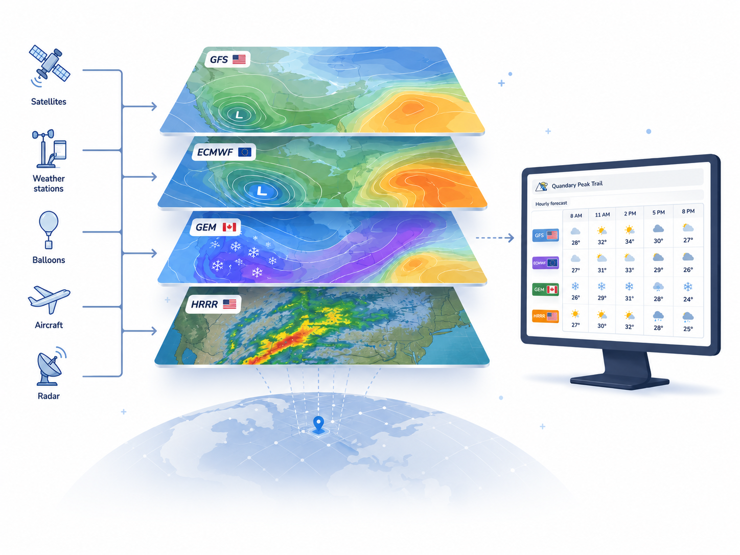
One atmosphere, different approaches
Forecast centers combine observations from satellites, weather stations, balloons, aircraft, and other sources to estimate the atmosphere’s starting state. Some systems also assimilate radar observations. The model then steps that state forward using equations for motion, heat, moisture, and pressure.
The grid cannot represent every ridge, cloud, or gust. Each model makes different choices about resolution, data assimilation, and processes that happen below the grid scale. Those choices create honest differences between forecasts.
Two comparison tools, two different jobs
TrekWeather offers a standard forecast comparison and a separate ensemble view. They answer related questions, but they do not use the same model choices.
Compare US and Canadian guidance
Choose the US forecast, which uses GFS plus HRRR where available, or the Canadian GEM forecast. The hourly comparison puts both forecasts side by side for the same place and time.
Compare ensemble systems
Compare the GFS, ECMWF, GEM, and WeatherNext ensemble means and optionally their percentile bands. This shows disagreement between systems as well as spread within each system.
Meet the model systems
These are forecast systems, not competing weather apps. TrekWeather uses each one for a specific role.
NOAA
GFS
NOAA’s Global Forecast System covers the globe at about 13 km resolution and updates four times a day. TrekWeather uses it for the broad and longer-range part of the US forecast.
TrekWeather presents an 8-day forecast window, even though the source model runs farther into the future.
Model detailsNOAA
HRRR
NOAA’s High-Resolution Rapid Refresh covers the contiguous United States at about 3 km resolution and updates hourly. Its useful range is much shorter than GFS.
You do not select HRRR separately. The US forecast uses it where its high-resolution coverage is available, with GFS supplying the broader outlook.
Model detailsEnvironment and Climate Change Canada
GEM
Environment and Climate Change Canada’s Global Environmental Multiscale system includes global and regional models. TrekWeather receives them as a seamless Canadian forecast.
The global model extends coverage worldwide, while higher-resolution regional models add detail where they are available in Canada and nearby areas.
Model detailsEuropean Centre for Medium-Range Weather Forecasts
ECMWF
The European Centre’s Integrated Forecasting System is another independent global forecast system. TrekWeather includes its ensemble in Forecast Uncertainty.
ECMWF is not a choice in the standard forecast selector. It appears alongside GFS, GEM, and WeatherNext when you compare ensemble means and percentile bands.
Model detailsGoogle DeepMind and Google Research
WeatherNext 2
Google DeepMind’s WeatherNext 2 is a different kind of system. Instead of simulating the atmosphere step by step, it learned patterns from decades of past weather and predicts what usually follows a given setup. It produces 64 ensemble members out to 15 days.
Because it reaches its forecast a different way than the physics systems, it brings a genuinely different opinion to the comparison. Its grid is coarser at about 25 km, it forecasts in 6-hour steps so the hourly view is smoothed in between, and it does not produce wind gusts.
Model detailsA model forecast is guidance, not ground truth
Mountain terrain can create weather at scales the grid cannot resolve. Before leaving, check current observations, official forecasts and alerts, and what the sky is doing. Update the plan when conditions stop matching the forecast.
Put it into practice
Compare the forecast for a place you know.
Start with the shared story, then inspect the differences that would change your plan.